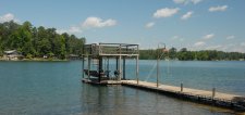
West Point Lake Water Level
WATER LEVEL
625.04
Feet MSL

Tuesday, December 30, 2025
   12:00:00 AM
Level is 9.96 feet
below full pool of 635.00
Lake Level Information
Preparing lake level chart...
Level Base: MSL
Full Pool: 635.00 feet
Flood Pool: 641.00 feet

Change Since Yesterday:  0.02 Feet
Level Controlled by: U.S. Army Corps of Engineers
Dam Name: West Point (CESAM)
Notable Infrastrucuture Levels
  • 470.0 Ft Alexander City water intake structure
  • 474.0 Ft Central Elmore (County) Water Authority water intake valve. Has difficulty drawing water below 474 feet because intakes are fed by gravity
  • 475.0 Ft Limiting water level for Alexander City and Coosa-Elmore Water Authority
  • 484.7 Ft till Waters Resort water intake

Daily Levels By Month Daily Levels By Month
Chattahoochee River River Levels Chattahoochee River River Levels
Forums West Point Lake Forums
Web Cams West Point Lake Cameras


WATER RESOURCE LINKS

U.S. Drought Monitor
GA Natural Resource Office


State Drought Monitor
Drought Intensity:
D0 - Abnormally Dry
D1 - Moderate Drought
D2 - Severe Drought
D3 - Extreme Drought
D4 - Exceptional Drought


The Drought Monitor focuses on broad-scale conditions. Local conditions may vary. See accompanying text summary for forecast statements.

U.S. Drought Monitor


Quick Links
West Point Lake News
West Point Lake Photos
West Point Lake Videos


About Us
Contact Us
Site Map
Search Site
Advertise With Us
   
www.WestPointLake.info
THE WEST POINT LAKE WEBSITE

Copyright 2025, Lakes Online
Privacy    |    Legal